Integration of a Global Position System into a Portable XRF Data Collection
INNOV-X Academic Grant Series
Saint Anselm College, Chemistry & Classics Depts Manchester, NH USA
Focus Introduction | 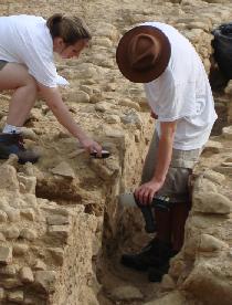 |
Experimental
Overview
This Brief describes the protocols that the research team has developed for the collection of in situ data by handheld XRF at the excavation site. For these analyses, a record of the analysis locations is important for subsequent data evaluation.
" … The quick analysis times of this non-destructive, portable instrument make it ideal for archaeology. … The procedures discussed here can be easily adopted to a variety of applications of this versatile and powerful instrument. …"
For this reason, they integrated global position system (GPS) data into their data collection protocols since beginning their studies. These procedures could, however, apply to any site analyses such as those used for environmental studies, building construction, etc. For many samples, additional and more extensive ex situ data were acquired later to confirm and support the in situ results.
XRF Specifications
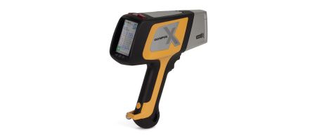
The Alpha Series portable XRF was used for all data collection. The analyzer has a Ag anode x-ray tube excitation source and a SiPin diode detector. The instrument was operated in "Soil" mode, which uses a 40kV excitation and a Compton Normalization algorithm for analysis. Power is provided by rechargeable Li-ion batteries. Control of the instrument and data storage is through a Hewlett Packard iPAQ personal digital assistant. Fluorescence signal was collected for thirty seconds for
each analysis.
Conclusions
As demonstrated by the work done by the archaeological team to date, a set of standard protocols for portable XRF data collection is vital to ensure the integrity of collected data. The procedures discussed here can be easily adopted to a variety of applications of this versatile and powerful instrument.
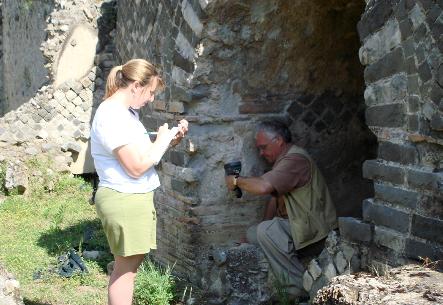
Figure 1. Research Team Collecting Field Data in Nympheum Niche
Data Collection Protocols Utilizing a Global Positioning System
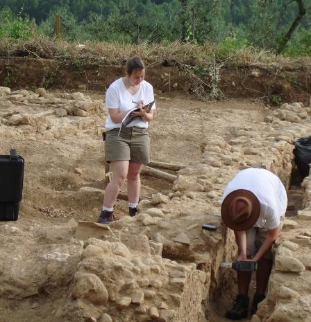
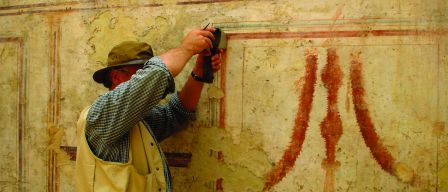
Data collection is performed by a pair of researchers. One researcher is responsible for the field notebook, GPS, and digital camera. The other researcher is responsible for data collection with the handheld XRF. Pictures of research teams at two excavation sites are shown in Figure 1 and Figure 2. In Figure 1, the GPS is laying on the wall just above where the one researcher is collecting data on a vertical wall surface.
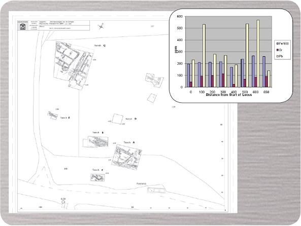
For each analysis, a flat and smooth sampling location is chosen that is larger than the analyzer spot size. A digital photograph of the sampling location is taken. The sampling location is brushed to remove loose debris, scraped with a trowel until clean material is observed, and then cleaned with a brush again. The analysis site location is determined using the handheld GPS and recorded along with the trench letter/locus number (the system used by archaeologists to map the excavation site), a general description of the sample type (i.e. mortar on top of wall, drainage deposit material, etc.), and the digital photograph number in a field notebook. The instrument window is cleaned with a cloth and the instrument window positioned directly on the cleaned sampling location.
Fluorescence signal is then collected, holding the instrument with two hands to ensure its steadiness throughout data acquisition. When possible an instrument holder was used to improve stability during data collection. After the first replicate at a particular sampling location, additional replicates are then collected without moving the instrument from the analysis site.
The instrument output, a list of elements found in each sample along with their concentrations and errors, is consulted approximately every ten sampling locations to look for trends, unusual results, and outliers. At the end of each day in the field, the XRF spectrometry data set for that day is uploaded as a spreadsheet from the instrument personal digital assistant to a laptop computer. The recorded field notebook information is added to the spreadsheet along with calculated means and standard deviations.
For many analysis locations, samples are collected for additional and more extensive analyses under controlled laboratory conditions. For these samples, a digital photograph is taken of the sample in situ. The digital photograph number, GPS location, trench letter/locus number, and a general description of the sample type are recorded in a sampling notebook. This notebook is separate from the field notebook discussed in the preceding paragraphs. A second copy of this data is recorded on a sample card. The sample is then removed from its location and sealed in a sampling bag. This bag and the sample card are then sealed in a second sample bag. All samples returned to the college are catalogued and sorted by excavation year and sample type in plastic bins.
Figure 2. Research Team Collecting Field Data on a Wall
Much of the data were collected by undergraduate students. To this end, separate protocol and instruction sheets for instrument operation, data collection, and data transfer were created. Multiple copies of these sheets were laminated and brought to the excavation site for daily use by the students. Students were provided with training on the instrument at the beginning of each excavation season, with second- and third-year excavators requiring only a review of its operation.
For additional information on this Research Work, please refer to the article, Comparisons of ancient mortars and hydraulic cements through in situ analyses by portable X-ray fluorescence spectrometry, in X-RAY Spectrometry, 2010, 39, 146-153, and/or go to the St. Anselm College Blog at http://blogs.saintanselmcollege.net/2007/06/03/orvieto2007/.
Innov-X Academic Grant Awarded for a second time to Principal Investigator, Dr. Mary Kate Donais. She and her colleague, Dr. David George, are professors at St. Anselm College in Manchester, NH, USA.
